 Satellite measurements of Arctic sea ice extent reveal a rapid decline over the past 30 years, particularly at the end of each year’s annual melt season. As the Arctic warms, the volume of ice in the region gradually declines; making it less likely ice will survive more than one year and thus exposing more open water at the end of each melt season. Some say the melt has slowed since 2012. Time will tell if it has and to what extent. Whether the ice decline is cyclic or the result of global warming is debated. From a Coast Guard point of view it does not matter. If the ice becomes water it becomes a Coast Guard responsibility.
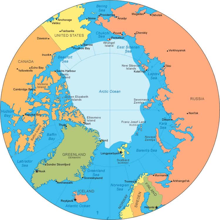
A 1982 United Nations treaty signed by more than 150 countries gives every country with a border on the Arctic Ocean control of an area up to 200 nautical miles off its coast and whatever natural resources might lie beneath the ocean’s surface. This seemingly straightforward rule is complicated by another regulation that allows countries to extend their waters up to 350 nautical miles or 100 nautical miles beyond 2,500 meter isobath, which is a line connecting the depth of 2,500 meters, if they can acquire scientific data that demonstrates that additional areas are a natural extension of their continent.
Beginning in 2005 a significant amount of interest has developed in the Arctic Ocean and its features. Three factors are important in driving this new level of interest in the Arctic. First, an enormous amount of oil, natural gas and other resources are thought to be held within the Arctic Ocean’s floor. The United States Geological Survey estimates that up to 25% of the world’s remaining oil and natural gas resource might be held within the Arctic Region. Second, Arctic warming is starting to reduce the extent and thickness of the Arctic’s sea ice. If the current trend continues, the Northwest Passage might be open to standard ships during summer within the next couple of decades and the Arctic could be ice-free in summer by midway through the current century. Third, the determination of ownership will not be fully established until the shape of the underlying bed is known. Mapping the bottom of the ocean is no easy thing, particularly when the ocean is covered by ice. The reduction and thinning of the Arctic sea-ice now taking place accommodates the acquisition of scientific data a nation can use to demonstrate that additional areas are a natural extension of their continent. Many nations are fielding scientific missions in hopes of extending their Arctic opportunities.
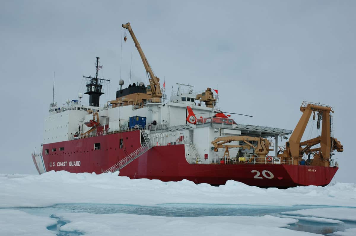
The Coast Guard has regularly supported scientific expeditions to the Arctic. In 2005 the Coast Guard Icebreaker Healy supported and participated in The Hidden Ocean Arctic 2005 Expedition which focused on accessing the diversity of life and environment. In 2007 the Healy conducted an Arctic mapping expedition using sophisticated echo sounders.
Russia, like other northern countries, has taken an aggressive stance. In a dramatic testing of international law, in August 2007, two submersibles placed a Russian flag under the ice cap at the North Pole. Canada, Denmark and Norway are also looking to claim waters extending out from their sea-bed and the United States is pursuing Arctic opportunities off the coast of Alaska. But apart from the Russian claim there are other disputes. The United States and Canada argue over rights in the North-West Passage, Norway and Russia differ over the Barents Sea, and the Russian Parliament is refusing to ratify an agreement with the United States over the Bering Sea. Disputes can be settled independently or through a U.N. tribunal. The United States is limited to independent agreement at the present time because the Senate has not ratified the treaty. It is not known when and if the U.S. Senate will affirm the treaty. There are significant concerns as to the breadth and ambiguity of the treaty, and more importantly, the risks to U.S. sovereignty due to issues regarding enforcement and adjudication.
The multi-year polar ice was smaller in September 2007 than has ever been recorded. Between 2006 and 2007 the polar ice pack lost an area 15 percent greater than the size of Texas. Polar melting has been a reality regardless of the cause and the Coast Guard has a lot of questions about what its Arctic Mission could end up being. The weather is harsh and distances are vast. Everyday duties such as search and rescue, maritime security and law enforcement will be more complex and difficult to perform above the Arctic Circle and additional duties dependent upon how mineral and resources will be administered and what islands and waterways the United States will defend may come to pass.
The Coast Guard is addressing the dynamics of the situation. RADM Arthur E. (Gene) Brooks USCG, when Commander of the 17th Coast Guard District began the development of Arctic Domain Awareness (ADA) by sending Kodiak C-130s on bi-weekly maritime surveillance patrols along the Northwest and Northern Alaska coasts. They found the Pollack fishing fleet had moved to the high Bering Sea and ships were sighted in the Chuckchi Sea that were not expected to be there. In October of 2007, a Kodiak based C130 aircraft made an Arctic Domain Awareness flight to the North Pole and back from Pt. Barrow. The 2300 mile round trip took eight hours. The purpose was to see how instruments and radio communications worked; navigation reliability; what forward support is needed; and cold weather limitations on the flight envelope. As an example of cold weather flight limitations; the fuel tanks on the C-130 are not heated. At -46 degrees centigrade the fuel gels. The temperature along the planned flight path was below the predicted temperature and with 500 miles to go the temperature fell to -40 degrees centigrade and stayed there. The normal Alaskan practice of dropping your altitude to raise the temperature does not work in the Arctic. The flight also proved again that leaving an aircraft out overnight with temperatures below freezing leads to substantial extra maintenance. A hangar would be required for Barrow operations.
An operational concept was developed to; First conduct seasonal C-130 patrols from Nome to insure aircraft availability during the summer when Pollock fleets moved north and also provide easier access to the Chukchi Sea and the North Slope; Second, it was planned to conduct a full range of Coast Guard operations at Barrow, the only community along the North Slope with sufficient existing infrastructure to support helicopters, small boats and their crews; and Third, to conduct MSST security operations at Prudhoe Bay, a site where inshore security operations might be required.
The concept was put into practice and an exercise, code named SALLIQ, began in late June of 2008. LCDR Michelle Webber was designated officer-in-charge of two HH-65 helicopters, two 25 foot boats and 36 Coast Guard personnel. LCDR Webber said they will build a requirements list for what might be needed in the future, identify any obstacles, and test the ability of existing communications equipment to operate in the area. The deployment was scheduled to last three weeks. Depending on requirements Barrow may become an ongoing seasonal facility. Simultaneously a C-130 aircraft was assigned to operate out of Nome for the entire season. Search and rescue requirements are being addressed. During mid August the MSST team was deployed to Prudhoe Bay. A 378 WHEC was deployed to North Slope for operational evaluation. The summer evaluation reaffirmed the lack of organic capability and no infrastructure. RADM Brooks stated; “The issue of the full-functioning operations-the requirement to do everything we do in southern Alaska in northern Alaska, at least seasonally – will take several years to ramp up to capability.”
Other Arctic operations were also scheduled. The icebreaker Healy departed Barrow 14 August to create a three-dimensional map of the Arctic Ocean floor in the Chuckchi borderland. The Healy launched on 6 September 2008 and again in September of 2009, in company with scientists and a Canadian icebreaker, to determine the thickness of sediment in the region. That is one factor that a country can use to define its extended continental shelf. The need for additional icebreakers is being addressed. The buoy tender Spar sailed from its homeport of Kodiak to make the most thorough accounting yet of the state of Arctic navigation. Its crew will access the needs for lights, buoys, and transit separation systems.
Commercial activities are expanding in two primary areas; the extraction of oil and natural gas and the mining of hard minerals. Both Shell oil and Conoco Phillips acquired the permits to drill for oil
In May 2011 an Arctic Rescue agreement was concluded among member states of the arctic Council. The Coast Guard has sent outreach teams into the North Slope for several years. In 2012 the Coast Guard deployed two MH-60 Jayhawk helicopters with support teams to Barrow to reduce response time to incidents in the Chukchi and Beaufort seas. From July to October, they operate from July to October out of a small rented hangar at the Barrow Airport. The ice breaker Polar Star has been re-commissioned and will join the Healy. Infrastructure on the North Slope remains an operational requirement
The situation in the Arctic is dynamic. No one can unequivocally predict with certainty future developments. Expanding activities in the Arctic will require increased presence, oversight, regulatory enforcement and contingency response on the part of the Coast Guard. This will necessitate a continuous assessment and strategic planning.