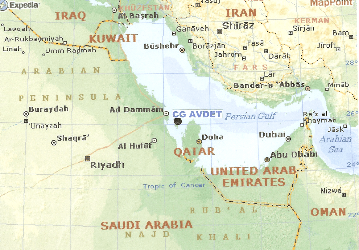
 Iraq intentionally released some 11 million barrels of oil into the Persian Gulf contaminating more than 800 miles of Kuwaiti and Saudi Arabian coastline. The amount of oil released was 20 times larger than the Exxon Valdez spill in Alaska and twice as large as the previous world record oil spill. In response to the Iraqi action of firing oil wells and pumping stations that caused oil spills in the Gulf, a Coast Guard aviation detachment (AVDET) supporting HU-25B Falcon jets equipped with Aireye technology was deployed to Manama, Bahrain as part of the Interagency Assessment Team (USIAT).
The deployment of a self-sustaining Coast Guard AVDET into a war zone was something new for the Coast Guard. Preparation and planning was a priority. AVDET personnel were assigned. Wills, medical records and passports were made current. Provisions were made to coordinate flight planning, international clearances, provide for refueling and security. Aircrews underwent short-notice training in desert survival, theater intelligence, chemical, biological, and nuclear warfare. Protective chemical suits were obtained for AVDET personnel. The aircraft were not armed but small arms training in the M-16 and 9MM was conducted prior to deployment. The aircraft were not repainted because high visibility was desired. Mode IV Identification Friend or Foe (IFF) was installed to provide in-theater electronic identification. Army Battle Dress Uniforms (BDUs) were obtained along with an initial issue of basic field equipment. Realizing that they would be operating in a harsh desert environment over 6,000 miles from the normal supply source, a comprehensive Pack Up Kit (PUK) was developed to support the aircraft and AIREYE systems.
Ten days after the initial request the AVDET was ready! On 7 February official word came to deploy. The Forward Operating Base (FOB) was located in Bahrain, a small nation located 12 miles off the coast of Saudi Arabia. An Advance Team departed for Bahrain two days later to verify planning assumptions, possible changes to PUK support, AVDET structure and obtain administrative, berthing, messing and operating facilities. On the evening of 16 February two HU-25Bs arrived at Bahrain and were met by the advance team and members of the USIAT. Two Coast Guard C-130s arrived several days later with the support equipment.
Prior to AIREYE arrival, all oil spill observation was done visually by Navy C-12 aircraft and helicopters at an altitude of 500 feet. The HU-25’s AIREYE operations were flown at altitudes between 6,000 and 12,000 feet using a straight line course with an extremely powerful radar emitter. Everyone, both friendly and unfriendly with an electronic warfare (EW) receiver, within 100 nm of the HU-25Bs would know their exact location. USIAT had operational control but the Navy had tactical control. A Navy EP-3 unit with a similar mission profile provided invaluable assistance. They provided intelligence and aircrew briefing support. Threats were defined. The biggest threat was “blue on blue” engagements or friendly fire. Second was possible Iraqi ground fire from oil platforms or small patrol boats. The ground threat consisted of SA-2 (long range radar guided), SA-7 (short range hand held IR guided), SA-13 (short range IR radar guided) surface to air missiles (SAMS) and standard Anti-Aircraft Artillery. The mapping profile area was well within the effective envelope of all weapons. Additionally, it was determined that the APS-127 surface search radar electronic signature closely matched the fire control radar mounted on Iraqi F1 Fighter/bomber for their Exocet missiles. Considering there were over 60 AAW missile-equipped warships in the Persian Gulf, HU-25s were flown with the APS-127 circuit breakers tie wrapped in the off position. The APS-131 SLAR radar, the primary oil mapping tool, did not present this problem.
Missions were scheduled on the Air Tasking Order (ATO) which was prepared by CENTCOM headquarters. Each sortie was listed by line number, aircraft type, time on scene, assigned IFF mode, altitudes, airspeeds and a brief mission description. Take off was made in accordance with schedule and the crew immediately checked in with Anti-Aircraft Warfare Coordinator (AAWC – an Aegis cruiser) which verified aircraft and IFF code. The AAWC worked non-stop checking aircraft in, providing vectors for air to air refueling and handled strike packages (groups of attack aircraft) off to E-2Cs (strike control) working to the north.
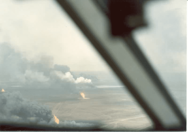
The AIREYE system worked extremely well. In less than three hours the crew was able to map over 40,000 square miles and virtually show every drop of water. There were two mapping missions flown each day. USIAT used the mapping product to produce a daily updated surface analysis of the location, condition and drift projection of the oil. After the cessation of hostilities, the mission was expanded to also provide observation of the smoke plume created by hundreds of oil well fires burning throughout the Kuwaiti oil fields. Mission requirements were reduced to one a day as the released oil dissipated, sank, or washed ashore. At the end of April the AVDET was released and returned to the United States.
The Coast Guard AVDET “mapped” over 40,000 square miles completely identifying the oil spill, conducted photo reconnaissance, smoke determination, and deployed sea current drift buoys. Photographs confirmed the source as the oil terminals at Mina Al Bakr. The AVDET was deployed 84 days, flew 427 flight hours and maintained an aircraft readiness rate of over 96%. All of this was accomplished 6,000 miles from existing maintenance and supply facilities with a high degree of professionalism and competency.
AIREYE is a sophisticated airborne sensor system consisting of Side Looking Radar (SLIR), an Infrared/Ultraviolet Line Scanner (IR/UV), a Laser Illuminated Low Light Television System, a Mapping Photo Camera, and a computer based Sensor System Operator Console. The system produces computer enhanced “near real time” imagery aboard the aircraft. The system has multi-mission capabilities, one of which is the efficient detection of oil pollution violators. The SLIR is the primary sensor. The IR/UV line scanner can detect very thick to extremely thin oil slicks, day or night.