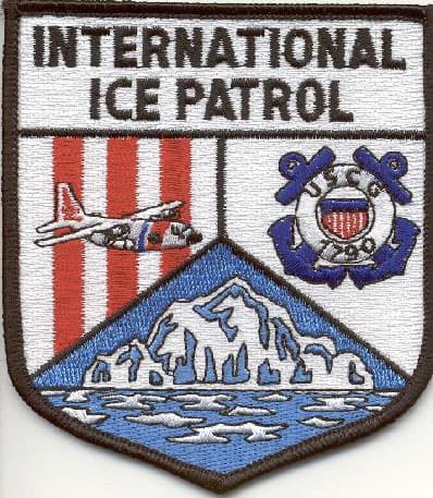
 At 11:40 pm April 14, 1912, four days after departing Southhampton, England, the RMS Titanic collided with an iceberg 400 miles south of Newfoundland, with the loss of over 1500 people. This disaster was the impetus for the establishment of the International Ice Patrol. Media coverage created an awareness of an icebergs potential for tragedy and created sufficient public reaction in Europe and the United States to prod reluctant governments into action. The result was the first Safety of Life at Sea (SOLAS) convention in 1914. The convention, representative of the world’s various maritime powers, provided for an international derelict-destruction, ice observation, and ice patrol service, consisting of vessels which would patrol the ice regions during the period of danger from icebergs and attempt to keep the trans-Atlantic lanes clear of derelicts during the remainder of the year. The United States Government was invited to undertake the management of the service with the expense defrayed by thirteen nations interested in trans-Atlantic navigation. On February 7, 1914, the President of the United States directed the Revenue Cutter Service to begin the International Ice Patrol as early as possible. The Revenue Cutter Service became part of the U.S. Coast Guard in 1915. Congress enacted legislation in June of 1936 formally requiring the Commandant of the Coast Guard to administer the International Ice Patrol and described in general fashion the manner in which the Patrol was to be performed. With only minor modifications, this remains today as the basic Coast Guard authority to operate the International Ice patrol.
To accomplish the mission search areas are determined by available ice information over the Grand Banks, prevailing weather conditions and the activity of the Labrador Current. The primary objective of the patrol is to ascertain and disseminate information concerning the southern limits of the iceberg threat. A secondary objective is to fix the location of as many icebergs as is consistent with the accomplishment of the primary objective.
The principal origins of icebergs that reach the North Atlantic Ocean are the 100 or so major tidewater glaciers of West Greenland. Between 10,000 and 15,000 icebergs are calved each year. Glaciers are formed by thousands of years of snowfall accumulation which eventually is compressed into ice. Being fresh water they will float and be carried by ocean currents. It is estimated that these glaciers account for 85% of the icebergs which reach the Grand Banks of Newfoundland. Other sources of icebergs are the East Greenland glaciers, which produce about half the amount of icebergs as the West Greenland glaciers, but account for only 10% of the icebergs reaching the Grand Banks. The remaining 5% are thought to come from glaciers and ice shelves of northern Ellesmere Island.
The cold Labrador Current carries some of the icebergs south to the vicinity of the Grand Banks and into the great circle shipping lanes between Europe and the major ports of the United States and Canada. Vessels transiting this area try to make their voyage as short and as economical as possible. Therefore, ships in the vicinity of the “limit of all known ice” normally will pass just to the south of this boundary. Vessels passing through Ice Patrol’s published ice limit run the risk of a collision with an iceberg and insurance concerns. In this area the Labrador Current meets the warm Gulf Stream and the temperature differences between the two water masses, of up to 20 degrees Celsius, produces dense fog. The combination of icebergs, fog, severe storms, fishing vessels and busy trans-Atlantic shipping lanes makes this area one of the most dangerous. Iceberg information is made continuously available to interested parties.
The present Ice Patrol operations area is bounded by the area 40 to 52 North and 57 to 39 West. It is within this area that the dangerous area is defined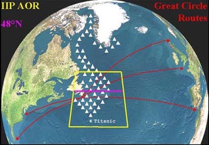 each iceberg season. The severity of an iceberg season is determined by an estimate of the number of icebergs drifting south of latitude 48 North. The reason for selecting latitude 48 North is tied into the great circle routes between Europe and the United States. Up until 1988 the estimate of the number of icebergs was derived from hand counting and model inputs. Starting in 1989, computerized techniques were developed using iceberg drift and deterioration models and sighting data.
From its inception until the beginning of World War II, the Ice patrol was conducted by two Coast Guard Cutters alternating surveillance patrols of the southern ice limits. In 1931 and thereafter a third cutter was assigned to perform oceanographic observations in the vicinity of the Grand Banks. With the resumption of the Patrol after World War II aerial surveillance became the primary ice reconnaissance method with surface patrols phased out except during unusually heavy ice years or extended periods of reduced visibility. Use of the oceanographic vessel continued until 1982, when the Coast Guard’s remaining oceanographic vessel was converted to other uses. The aircraft has distinct advantages for ice reconnaissance providing much greater coverage in a relatively short period of time.
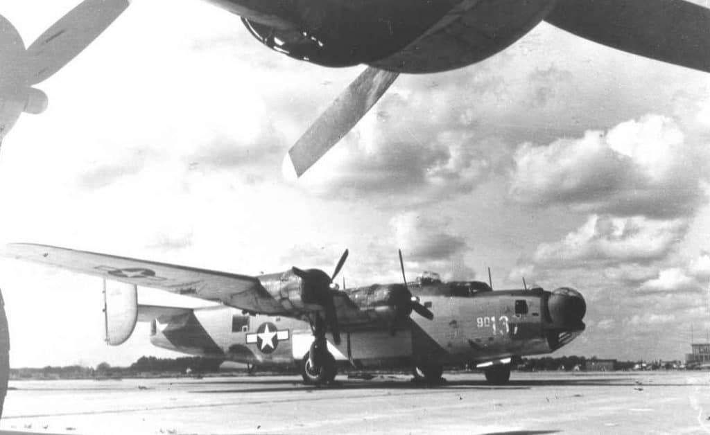
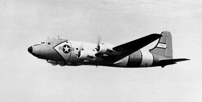
On July 12, 1945 the administrative control of VP-6CG was transferred from FAW9 to the Commandant of the Coast Guard. A month later the squadron was transferred to facilities at NAS Argentina, Newfoundland. The aircraft complement was six PBY-5As and two PB4Y-1s equipped with AN/ASP-15A radar used for ice reconnaissance. In January of 1946 the Coast Guard again became part of the Department of the Treasury and aircraft of the decommissioned VP-6 became an air detachment, based at NAS Argentia, assigned to the North Atlantic Patrol. (NORLANTPAC) NORLANTPAC responsibilities included ships and crews manning almost a dozen Ocean Weather Stations in the Atlantic Ocean; operating the electronic LORAN navigation system from isolated land based stations in Newfoundland, Labrador and Greenland; and the operation of the International Ice Patrol using both ships and aircraft. The air detachment was further charged with providing search and rescue services for both civilian and military entities. During the ice season of 1946 the International Ice Patrol was resumed and the Coast Guard air detachment assumed primary ice surveillance responsibility using the two PB4Y-1s. The aircraft were assisted by the Coast Guard Cutter MOJAVE.
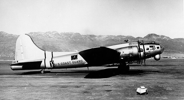
In 1947 the NORLANTPAC Air Detachment was formally commissioned as Coast Guard Air Detachment Argentia. The unit had two PBY-5As attached and the PB4Y-1s had been replaced by two PB-1G aircraft. PB-1G aircraft conducted Ice Patrol surveillance during the period 1947 through 1958 at which time they were replaced by R-5D aircraft which were in turn were replaced by HC-130 aircraft in 1963. HU-25 aircraft were used in 1989 but proved to be range limited.

During the period 1947-1982 visual aerial reconnaissance was conducted. Compared to today’s standards the procedures used were rudimentary and unsophisticated. Until 1964, when Doppler navigation equipment was installed on the aircraft, the primary navigation available was LORAN-A. The radar in use could not distinguish between a ship and an iceberg so during periods of reduced visibility, when a radar contact was made, the aircraft would approach the target at an altitude of 300 feet, determined by a radio altimeter, for visual identification. The flight path flown resulted in the target passing close in on the starboard side of the aircraft. When an iceberg was identified its position was noted and logged into the flight report which was turned in upon return to base. The Ice Patrol maintained a hand plot of iceberg positions and predicted motion. The PB-1G search track was 1000 miles and the normal mission was 12 hours. The R5-D operation extended the search track to 1200 miles. This was extended to 1500 miles with the HC-130B and again extended to 1800 miles with the HC-130H. A standard parallel track search pattern was used. During heavy seasons, or when operations dictated, two aircraft based out of Argentina were used.
The Coast Guard conducted experiments to determine means for accelerating the disintegration of icebergs. It was determined that approximately one- hundred 1000 pound charges of conventional explosives would be needed for the destruction of an average berg. Furthermore, to melt a medium-size berg of 100,000 tons would require the complete theoretical heat of combustion of over a quarter of a million gallons of gasoline. Such methods are of course economically as well as practically unsound.
From 1947 until 1970 Ice Patrol reconnaissance aircraft were based out of the air detachment at Argentia, Newfoundland. The Coast Guard Air Detachment Argentia was decommissioned in 1966 but a C-130 deployed out of the Elizabeth City Air Station to Argentia for the next four years. With the closing of NAS Argentia in 1970 the deployed aircraft operated out of the Canadian Forces Base at Summerdale, Prince Edward Island. This resulted in increase transit time and decreased search time and as a result the operation was moved to St. Johns, Newfoundland.
In 1973 inertial navigation systems were installed on the aircraft followed by GPS in the early 1990s. 1983 saw the introduction of the APS-135 Side Looking Airborne Radar (SLAR). The use of SLAR altered the Ice Patrol aircraft deployment schedule. A C-130 was no longer deployed to Canada on a continuous basis during the ice season. A SLAR equipped aircraft was deployed for a one week period every other week.
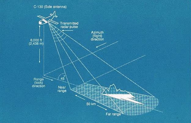 The SLAR provided a near all weather target detection capability. Patrols were conducted at 6000 – 8000 feet with a 25 mile track spacing providing an overlapping coverage of the search track increasing the probability of detection considerably. Cloud cover and fog is no longer the problem it once was. An experienced operator, by matching movement or lack of movement on different legs of the search pattern could determine whether the target was an iceberg or a vessel. In 1993 the AN/APS -137 Forward Looking Airborne Radar (FLAR) was added as an additional sensor. The FLAR automatically tracks target course and speed. The two systems, although not fully integrated provide all weather detection of icebergs. The combination of the two systems has allowed the International Ice Patrol to increase flight track spacing to 30 nautical miles and still maintain 200 percent coverage of an expanded area with less flight time per ice reconnaissance flight.